Portfolio
The following are comprehensive GIS projects, inspired by decades of innovative techniques and geospatial resources.
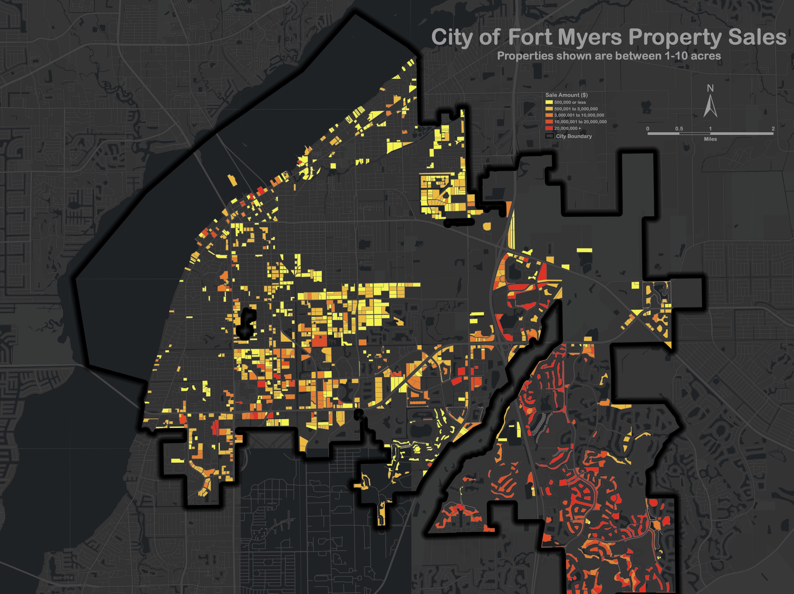
Property Data Map
We were asked to create a map showing how much parcel owners paid for one- to ten-acre properties in the City of Fort Myers. It combines an industry-renowned basemap with the property symbology and was well received for aesthetic appeal.
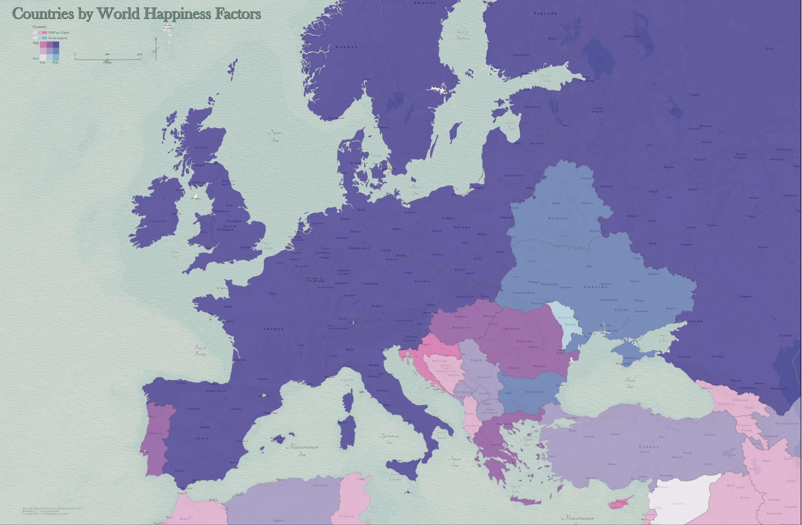
Multivariate Map
This map shows multiple variables at the same time using two sets of colors. Data was obtained from the World Happiness Report. It was then symbolized and overlaid onto a modern antique background, which serves as the basemap and theme.
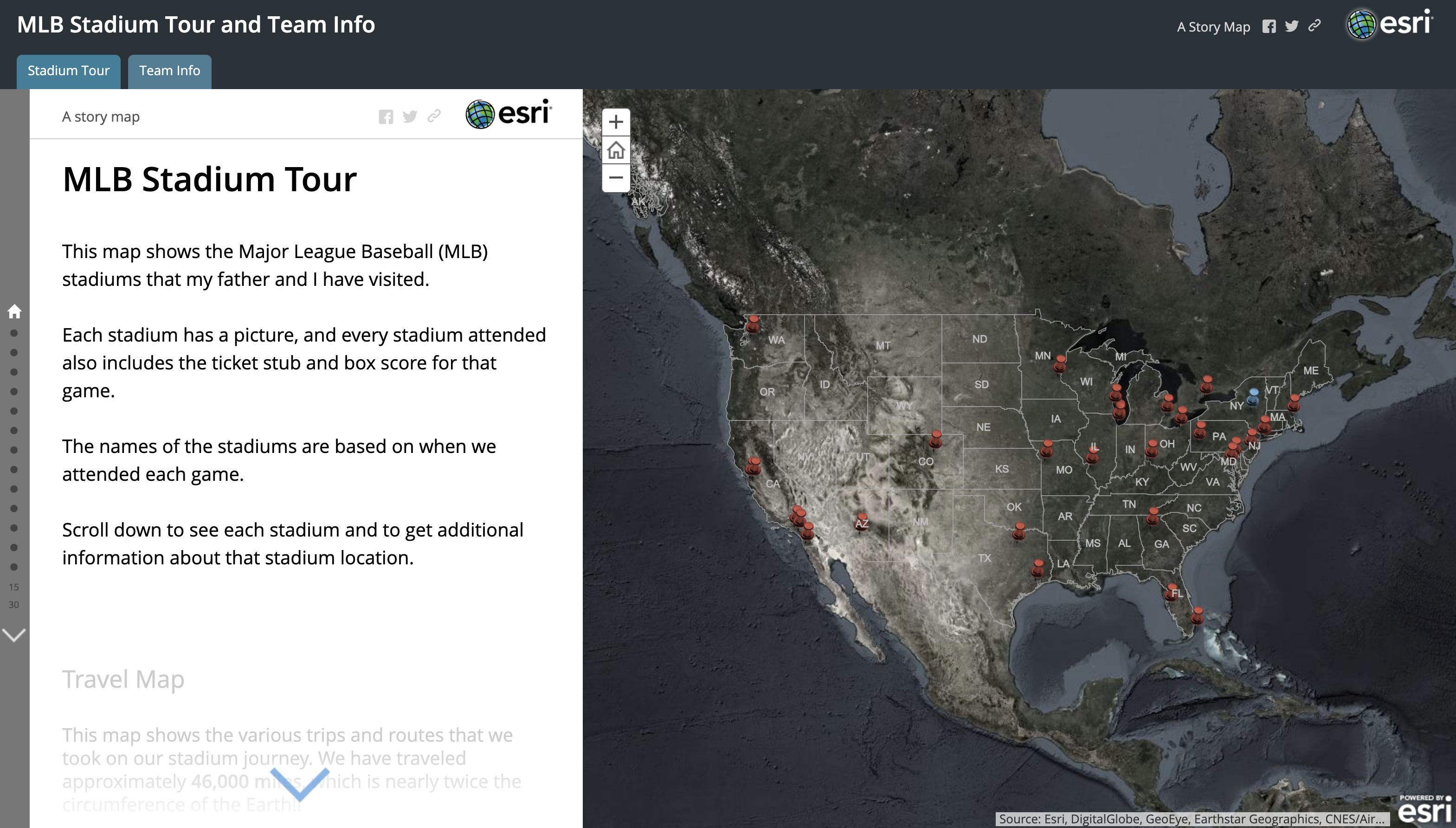
“Play Ball!” Story Map
This innovative story map showcases our Founder & CEO’s 18-year journey with his father to every MLB stadium. Complete with aerial images, intriguing anecdotes and baseball trivia, this personal piece was proudly displayed at the 2015 Esri Southeast User Conference in Nashville, TN where it took home the People’s Choice Award.
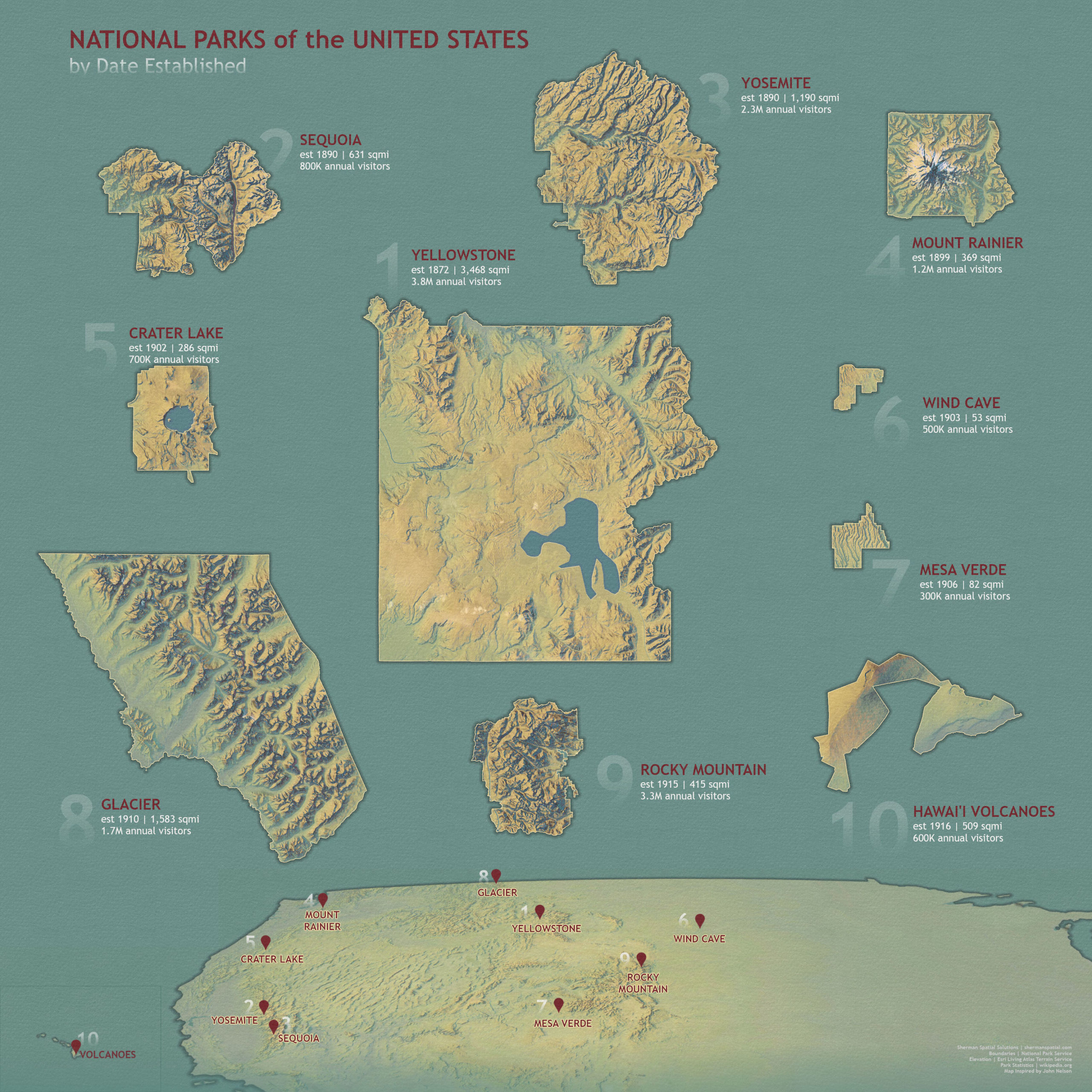
National Parks
This map shows the 10 oldest national parks, based on the date that each one was established. It incorporates imagery, terrain, hillshade and multidirectional hillshade services from the Esri Living Atlas.
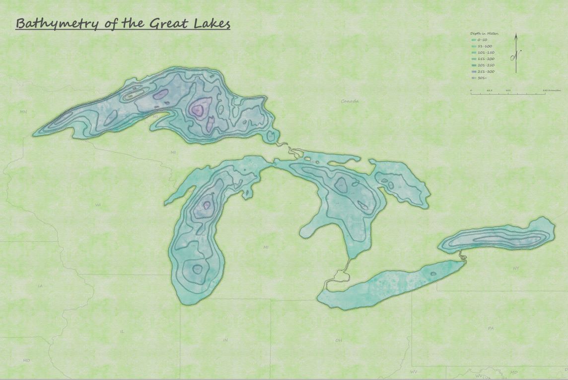
Great Lakes Bathymetry Watercolor
Our team obtained and downloaded bathymetry data for the Great Lakes. To maintain the historic authenticity of this information, while making it visually impactful for users of all ages, we applied a watercolor theme that suggests the map was drawn and painted by hand.

Great Lakes Bathymetry Woodcut
This wooden-themed, framed palette complements the previous watercolor map, giving it a three-dimensional appearance for rustic influence and purpose.

NYC Transit Map
Sherman Spatial Solutions was asked to develop a transit map of New York City’s subway lines and routes. GIS professionals set up a grid system of points, much like a pegboard, using the ArcGIS Pro desktop program. The results were lines, points, bodies of water and airports for residents’ and tourists’ reference.